


What’s Missing?
The world of technology and information has changed dramatically in the last twenty years. Wireless communication and blue tooth devices power the daily lives of billions of people. Entirely new technologies from AI, smart cities, drones to driver-less vehicles have appeared, and the IoT (Internet of Things) is creating a mesh of connectivity that changes every part of daily life. But the basic detection of dangerous weather still relies on technology installed decades ago. Because of this, we still can’t react fast enough to dangerous weather conditions such as tornadoes. This is why I have spent the last decade in this industry and the past several years laser focused on plowing through every challenge and naysayer to bring a new technology to the public. Some people scratch their heads in disbelief when I describe what we are developing in our breakthrough NIMBUS® technology.
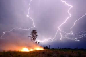
In this series of blogs, I will explain why the things you are relying on today for weather information must be improved and how the NIMBUS® is going to help make that happen. Most people turn to their TV, phone app, radio or simply look at the sky above them for weather info. Here are a few weather facts. A bolt-of-lighting can strike from up to ten miles away even when the sky is blue. Seventy percent of injuries and facilitates due to lightning occur after the storm has passed and a bolt of lightning occurred from the trailing edge of that storm long after it had passed by. Counting “one thousand one, one thousand two, one thousand three….” after you hear thunder is simply not an accurate form of calculating when you need to take shelter. Phone apps, weather reports, radar, and big news equipment that everyone is relying on for FAST information isn’t fast at all. Most weather information you think is real-time actually happened 10 or 15 minutes ago and is just now reaching you! Plus the details you see on your lightning map app or TV typically cover large blanketed areas and may not accurately cover your specific location.
Meteorologists use thermometers, anemometers, barometers and satellites that photograph Earth’s weather from their orbit in space. Balloons monitor upper-air data and weather spotters call in reports while daylight permits. These stations measure weather conditions such as temperature, atmospheric pressure, wind speed and direction, amount of cloud cover, and precipitation for use in creating weather maps. The data collected is shared to the public via weather reports, internet programs and is often old by the time it reaches you. Existing handheld products include wind meters, and lightning detectors. Almost all handheld lightning detectors were created or are knockoffs and failed reverse engineering attempts that my company’s Chief Technology Officer developed over the past 30 years. He was inspired to develop advance warning of lighting when he read an article about a little boy who was struck and killed by lightning while playing ball. The story that appeared in the newspapers called it a tragedy that was unavoidable. Well, this man thought there was a better answer and he went out and developed the first commercial handheld lightning detector.
Much has happened since his first creation. The world has become digital in almost every way, and the NIMBUS® technology we are creating has been developed specifically to play an important role in this new digital reality. One example is the presence of cellphones everywhere. They didn’t exist when the first storm detection products were being created, and for this reason they are a source of false alerts in older products. What makes The NIMBUS® so unique and how will it make a difference? The NIMBUS® proprietary sensor (which is small enough to fit in the palm of your hand), is continuously tracking, storing, updating and analyzing storm and threat data every milliseconds to provide fast and easy to understand notifications to the user. The NIMBUS® alerts the user of lightning, squall lines and up to 50 storms at a time, all within a 600-mile radius of your location. The NIMBUS® tells the user the estimated time of arrive, time-to-clear, how fast the storms are coming and from what direction. The NIMBUS® is also notifying the user of cloud-to-cloud and cloud-to-ground lighting as well as pre-tornado conditions and much, much more. Once fully developed we will be able to give up to two hours advance warning of a tornado.
Today people receive a few minutes of warning or no warning at all! The NIMBUS® technology platform is no tinker toy and definitely not your moms jeans. What we have done doesn’t exist in any text book (yet). We’ve cracked the code on low frequency magnetic-field detection of severe weather and other threats. Our mission is to enhance weather information by providing the kind of real-time and accurate information that the public needs to make real-time decisions in the real world. Really. If you want to learn more about our technology and see how completely nerdy I really am, visit our website. We all have something we are passionate about. This is mine. Thanks for taking the time to read. Follow your passion!